Achhhhh, alright, Mrs. Graham has requested that we post this advertisement here along with additional information on her business?

Mrs. Graham is of course the housekeeper for Reverend Wakefield of Inverness, but she has a number of other small business interests as well. She is the leader of the local chapter of Druidic Dancers and Callers, runs a part time business of fortune telling- for more information on personalized tea leaf readings contact her at her private residence in Inverness, and it seems that she is the owner of a small but thriving tour business that specializes in very specialized and unique travel packages. She was quite upset with our initial insistence that Crag na dun does not exist. She has went so far as to threaten us with a libel suit and states that our information could damage her business as well as her professional reputation.
Because of this pending litigation, we feel obligated to give Mrs. Graham equal space in which to defend her claims and thereby promote her business…

Mrs. Graham insists that Yes, indeed Crag na dun does exist but that it’s secret location is a crucial key to the success of her business. She compares the secrecy of location to that of secret recipes and formulas used by Chefs, food, beverage and pharmaceutical manufacturers. For some time, Mrs. Graham has run a small tour agency that specializes in a very unique type of travel package. Recently, her business has become so popular that she had to take on a number of affiliates and partners to keep up with the enormous demand for these tours. She is happy to announce that the business has become a huge success, so much so in fact, that even with the addition of these affiliates, they are unable to fulfill some of the requests.
Crag na dun Time Tours would like to apologize for the delays and backlogs in meeting some of their customers’ inquiries and requests. If you are having difficulty contacting them, please be patient and understand that they are making every attempt to expand their business to meet your needs. They would also like to advise that at this time, due to an extremely high volume of travel requests to 1700’s Scotland, they are unable to accept any more reservations for that time period. The waiting list is already quite lengthy and the company has temporarily put a hold on any further travel to that time frame. An added advisement concerning this time frame, and the trips in general: Please read your pre-travel package and contract thoroughly before traveling. Crag na dun Time Tours does not promise or guarantee in any way that you will meet or encounter specific individuals… namely one James Malcom Mackenzie Fraser or any of his various relatives. It seems that a few customers have returned from their trips rather disgruntled and demanding their money back… Crag na dun time Tours has a no refund policy which is spelled out very clearly in the contract!
The company would like to take a moment here to inform travelers that they have refined their travel techniques over the years and successfully managed to break the 200 year time constraint that has plagued travelers for years. They are now able to send you as far back as any stone’s original building. They would like to advise however, that there is a great deal of risk the further back one goes, and they can not make any safety guarantees should you choose to go all the way back to the very beginnings.
The company does regret that it can not provide more 1700’s trips right now but is offering discounts on some other packages that might be of just as much interest to travelers. While they can not send you to the mid or later 1700s, they do have some limited packages available for late 1600s-early 1700s…this time frame would put you in the era of the first Jacobite Risings and one other somewhat famous rebel… Rob Roy MacGregor?
http://en.wikipedia.org/wiki/Rob_Roy_MacGregor


They are running a special on early 1300’s packages right now which include the time period of some other famous Scots, Robert the Bruce and of course, William Wallace.
http://en.wikipedia.org/wiki/Robert_the_Bruce
http://en.wikipedia.org/wiki/William_Wallace


In addition to these packages, the company is running some special promotions in honor of their newest affiliate, Castlerigg Stone Circles near Keswick, England! The Castlerigg circle and nearby town of Keswick have a long and rich history dating back to 3000 BC. Their varied history includes pre-history Druidic times, Roman occupations, Picts, Angles and Saxon invasions, Viking conquests and early Christian monks and monasteries as well as William the Conquerer’s son, William II.
http://en.wikipedia.org/wiki/Keswick,_Cumbria


Now hopefully this blatant plug for Crag na dun Time Tours will satisy Mrs. Graham and she will drop her pending litigation against us… Please take note, Mrs. Graham that we have even changed the title of the article to include a plug for your company!
First of all before we embark on this journey, we all need to be very clear on one important point. Crag na dun is a fictional Stone Circle created by Diana Gabaldon specifically for the Outlander series! It does not exist anywhere other than in her very creative imagination and the pages of the book. If you are planning to book a tour which includes a visit to “crag na dun”, please be advised in advance that the “crag na dun” you will be visiting will only be a representation of that place.

excerpt from Outlandish Companion regarding whether craigh na dun is a real location.
The Stones depicted in the show are Styrofoam and built as part of set design for location shooting.


What we are going to explore is some of the many real Stone Circles and ancient sites throughout Scotland and Britain. We will also delve into some other options for time travel… yes, there a great many of them out there! It is speculated an rumored that one could make the trip using various different methods? We’ll touch on a few of them later. Lastly, we will look at some other time periods that one might end up in when traveling… since that is a truly massive endeavor, we will limit the travel to time frames within the vicinity of Standing Stones or circles in more ancient Britain.
Let’s start our journey with the places that Diana mentioned in her references to Craigh na dun. She mentions Castlerigg, the Clava Cairns near Inverness, and Tomanhurich hill. Now, we are all aware that the mythical craigh na dun is located in the highlands of Scotland somewhere near Inverness? The first circle mentioned is not in this area, but well worth looking into.
Castlerigg Stone Circle
Castlerigg stone circle is located in Keswick in Cumbria North west England. One of around 1,300 stone circles in the British Isles and Brittany, it was constructed as a part of a megalithic tradition that lasted from 300 to 900 BCE, during the Late Neolithic and Early Bronze Ages.
Aside from the more famous Stonehenge, Castlerigg is a site that most of us would immediately identify with when we think of Stone Circles.
You can find more information on it here: http://en.wikipedia.org/wiki/Castlerigg_stone_circle


It is located near Keswick, Cumbria northwest England, so it would not be a plausible location for Craigh na dun. You can see it’s location on the map below, with the Keswick area starred.


As I mentioned, while it is not a location for Craigh na dun, it is an excellent representation of a Stone Circle. You might want to keep this site in mind if you prefer to travel back in time to England rather than the highlands of Scotland! It is still well formed with many of the Stones remaining, if that has any bearing on accuracy in determining one’s destination to the past? In fact, it is said that the number of stones is constantly changing. There is a tradition that it is impossible to count the number of stones within Castlerigg; every attempt will result in a different answer. This tradition, however, may not be far from the truth. Due to erosion of the soil around the stones, caused by the large number of visitors to the monument, several smaller stones have ‘appeared’ next to some of the larger stones. Because these stones are so small, they are likely to have been packing stones used to support the larger stones when the circle was constructed and would originally have been buried. Differences in opinion as to the exact number of stones within Castlerigg are usually down to whether the observer counts these small packing stones, or not; some count 38 and others, 42. The ‘official’ number of stones, as represented on the National Trust information board at the monument, is 40.
If you could put this site in some context to places and events within the Outlander series, it would be of interest in that is lies in the Lakes district where Jamie Fraser resided as a groom after his release from Ardsmuir Prison. Helwater Estate is located within the Lakes district. It’s location is also in a reasonable vicinity to Northumbria and Hadrian’s Wall, where Roger Wakefield’s Father, Jerry MacKenzie disappeared during World War II while testing a plane for Frank Randall and MI5, the British Intelligence force.
If one wanted to think about it’s other possible time travel connections to the more ancient past, it is considered much like Stonehenge, a most ancient Druidic worship site. If we look at the nearby village of Keswick and it’s history we can piece together the area’s history from those ancient and unknown druids to it’s strategic importance during Roman occupation with Hadrian’s Wall being in the western part of the county. There are Roman road passing by the present day town. Several Christian saints preached the Gospel in the north of England in the late 6th and early 7th centuries AD; in Keswick and the surrounding area the most important figures were St Herbert of Derwentwater and his contemporary St Kentigern. The former, the pupil and friend of St Cuthbert of Lindisfarne, lived as a hermit on an island in Derwentwater, now named after him. Kentigern, who lived and preached in the area before moving to Wales, is traditionally held to have founded Crosthwaite Church, which was the parish church of Keswick until the 19th century.
Keswick’s recorded history starts in the Middle Ages. The area was conquered by the Anglo-Saxon Kingdom of Northumbria in the seventh century, but Northumbria was destroyed by the Vikings in the late ninth. In the early tenth century the British Kingdom of Strathclyde seized the area, and it remained part of Strathclyde until about 1050, when Siward, Earl of Northumbria, conquered Cumbria. In 1092 William II, son of William the Conqueror, marched north and established the great baronies of Allerdale-below-Derwent, Allerdale-above-Derwent, and Greystoke, the borders of which met at Keswick. In 1181 Jocelyn of Furness wrote of a new church at Crosthwaite, Keswick, founded by Alice de Romilly, the Lady of Allerdale, a direct descendant of William II’s original barons. In 1189, Richard I granted the rectory of Crosthwaite to the Cistercian order of Fountains Abbey.
During the 13th century, agricultural land around the town was acquired by Fountains and Furness Abbeys. The latter, already prosperous from the wool trade, wished to expand its sheep farming, and in 1208 bought large tracts of land from Alice de Romilly. She also negotiated with Fountains Abbey, to which she sold Derwent Island in Derwentwater, land at Watendlath, the mill at Crosthwaite and other land in Borrowdale. Keswick was at the hub of the monastic farms in the area, and Fountains based a steward in the town, where tenants paid their rents. Furness also enjoyed profitable rights to the extraction of iron ore.
Now, knowing some of it’s history, you will be a bit better prepared should you decide to use Castlerigg as your time travel portal. If it is extremely powerful, and you are well versed and equipped in the navigation of travel, this portal could land you in the time of Druids, put you close to a Roman Outpost along Hadrian’s Wall, deliver you into the hands of Viking conquerors, or place you in close proximity to early Normans or Christian Monks… take your pick but choose wisely because all of those times could be quite dangerous for an unknown traveler.
The second place mentioned by Diana Gabaldon is Clava Cairns near Inverness. This the one more familiar to Outlander fans and followers.
Clava Cairns near Inverness
The Clava cairn is a type of Bronze Age circular chamber tomb cairn, named after the group of 3 cairns at Balnuaran of Clava, to the east of Inverness in Scotland. There are about 50 cairns of this type in an area round about Inverness. They fall into two sub-types, one typically consisting of a corbelled passage grave with a single burial chamber linked to the entrance by a short passage and covered with a cairn of stones, with the entrances oriented south west towards midwinter sunset. In the other sub-type an annular ring cairn encloses an apparently unroofed area with no formal means of access from the outside. In both sub-types a stone circle surrounds the whole tomb and a kerb often runs around the cairn. The heights of the standing stones vary in height so that the tallest fringe the entrance (oriented south west) and the shortest are directly opposite it.
Where Clava-type tombs have still contained burial remains, only one or two bodies appear to have been buried in each, and the lack of access to the second sub-type suggests that there was no intention of re-visiting the dead or communally adding future burials as had been the case with Neolithic cairn tombs.
These Stone sites around Inverness would be the most plausible locations for Craigh na dun as they are also located close to Culloden.
Culloden battlefield, a few miles to the east of Inverness attracts a huge number of visitors every each year. But only a few of those visitors realise that only a mile to the south east lies a very different link with the past, every bit as evocative as Culloden and in many ways more tangible, despite dating back to around 2000BC.
The Clava Cairns lie not much more than a cannon shot away from Culloden, and Jacobites fleeing the carnage of the battle may well have passed this way. Yet it is worth remembering that the seemingly huge distance in time back to the very different world of Culloden, some 250 years, is just one sixteenth of the distance we’d have to travel back in time to meet the builders of these cairns.
http://www.undiscoveredscotland.co.uk/inverness/clavacairns/index.html
http://en.wikipedia.org/wiki/Clava_cairn


The third site mentioned by Diana is Tomnahurich Hill.
Tomnahurich Hill
Tomnahurich Hill – which means hill of the yews -is a rounded tree covered hillock on the outskirts of Inverness, the hill has a wealth of traditions associated with it, and it is famed as an abode of the fairies. A modern cemetery now covers the hill.
The most enduring tradition connected with the hill is that fiddlers (or a fiddler) were lured into playing at fairy revelry, and emerged after one night beneath the hill to find that hundreds of years had passed in their own world. The story has two basic forms, in one a solitary fiddler falls asleep on the hill and wakes up in an underworld palace. He is made to play all night for the entertainment of the fairy queen, and finally awakes on the shores of the River Ness, later to discover that a hundred years have passed. The other story features two fiddlers and is outlined below:
The Fiddlers of Tomnahurich
Two travelling fiddlers were visiting Inverness looking for places where they could play, while searching for a suitable venue they met an old man in strange clothes, who asked them if they would perform for him. They agreed and followed the old man to the wooden hill of Tomnahurich, just as the sun slipped out of view over the Western horizon. There was an opening in the side of the hill through which they followed the old man into a brightly lit cavern hall, where a great feast was underway. The feast was attended by a host of people, all dressed in colourful finery, and each seeming to have an air of enchantment and beauty about them. They sat down at one of the many tables and preceded to enjoy the fine wine and the rich food served before them.
 Tomnahurich Hill When it came the time for dancing they played their fiddles and the party got into full swing, each fiddler playing better than they had ever played before. Finally, in what seemed like no time at all, the feast was over and it was time for the fiddlers to leave. Their noble company thanked them, and the old man who had led them into the hillside paid them with a bag of silver and gold coins. The fiddlers left the hill in a fine mood, and walked back towards the centre of Inverness. As they neared the town they saw that everything had changed, where there was once dense woodland buildings now stood, as if they had appeared overnight. All the people they met along the way were dressed in strange looking clothes, and poked fun at the fiddlers ‘old fashioned’ clothing.
The fiddlers decided that they had been enchanted in some strange way and made the return journey to their town. When they arrived they were dismayed to find that everything they knew here had also changed; their homes were no longer occupied and they recognised no one. In despair they ran into the local church where the local priest was in the midst of delivering a sermon. As soon as the priest spoke the word of God both fiddlers crumbled to dust in front of the eyes of the horrified congregation.
The difference in time between this world and the world of the fairy races is an important folklore motif found in many tales about the otherworld. The way the unfortunate fiddlers crumbled to dust after returning to their own world is also often found in folk tales such as that of King Herla.
There are many more traditions associated with the hill, Thomas the Rhymer is said to be buried beneath it, or to live within it, ready to lead an army of men and white steeds to rally Scotland in its hour of need. In Celtic myth Fion trained his dog to lead two of every species of animal around the hill in pairs to unravel enchantment by an Irish enemy.
Directions: The hill is just off the A82, to the West of the River Ness.
http://www.mysteriousbritain.co.uk/scotland/invernesshire/featured-sites/tomnahurich-hill.html
https://graveyardsofscotland.wordpress.com/2014/01/20/fairy-hill/
Besides Thomas the Rhymer’s supposed connection, the Brahan Seer is also connected to this Fairy hill, now cemetery. So, while there are no Stone Circles to be found here, you may still be able to travel through time at this site due it’s Fairy connections… I would be hesitant about using this one however, as the Fairy connection might even more risky than just time travel? I do suppose though if one was brave enough to try it, it might be an enlightening experience.


http://en.wikipedia.org/wiki/Thomas_the_Rhymer
Of course we can not bring up Thomas the rhymer without mention of the fairy realm!
http://en.wikipedia.org/wiki/Fairy
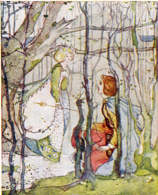
Thomas the rhymer be Katherine Cameron

The Eildon Hills where Thomas the rhymer supposedly met the past

In some legends, Guinivere is referred to as a fairy


The next site on our journey keeps coming up in any search for Craigh na dun or Standing Stones so I am going to include here as well. If you search the internet for Craigh na dun, one of the first sites listed is a link to Megalithic Portal and Callinish4. The link is a bit of a let down as it is just one quick picture and an answer to the query of what Craigh na dun looks like?
Callinish Standing Stones
http://www.megalithic.co.uk/article.php?sid=1146411369

The photo posted on Megalithic Portal was impressive and led us to visit the Callinish Stones directly!
The Callinish Standing Stones are located on the Isle of Lewis and are one of several stone sites on that island. The Isle of Lewis is located in the Outer Hebrides of Scotland.
The Outer Hebrides (Scottish Gaelic: Na h-Eileanan Siar, IPA: [nə ˈhelanən ˈʃiəɾ]) also known as the Western Isles and the Long Island, and as Innse Gall in Gaelic is an island chain off the west coast of mainland Scotland. The islands are geographically coextensive with Comhairle nan Eilean Siar, one of the 32 unitary council areas of Scotland. They form part of the Hebrides, separated from the Scottish mainland and from the Inner Hebrides by the waters of the Minch, the Little Minch and the Sea of the Hebrides. Scottish Gaelic is the predominant spoken language, although in a few areas English speakers form a majority.
Most of the islands have a bedrock formed from ancient metamorphic rocks and the climate is mild and oceanic. The 15 inhabited islands have a total population of 27,400 and there are more than 50 substantial uninhabited islands. From Barra Head to the Butt of Lewis is roughly 210 kilometres (130 mi).
There are various important prehistoric structures, many of which pre-date the first written references to the islands by Roman and Greek authors. The Western Isles became part of the Norse kingdom of the Suðreyjar, which lasted for over 400 years until sovereignty was transferred to Scotland by the Treaty of Perth in 1266. Control of the islands was then held by clan chiefs, principal of whom were the MacLeods, MacDonalds, Mackenzies and MacNeils. The Highland Clearances of the 19th century had a devastating effect on many communities and it is only in recent years that population levels have ceased to decline. Much of the land is now under local control and commercial activity is based on tourism, crofting, fishing, and weaving.
Sea transport is crucial and a variety of ferry services operate between the islands and to mainland Scotland. Modern navigation systems now minimise the dangers but in the past the stormy seas have claimed many ships. Religion, music and sport are important aspects of local culture, and there are numerous designated conservation areas to protect the natural environment.
http://en.wikipedia.org/wiki/Outer_Hebrides


The Callinish Stones are one of the most famous Stone sites in Scotland and closely comparable to Stonehenge in England. They date back as far as 3000 BC.
There were limited excavations in 1980-1 which provided some information on the development of the site. The first traces of human activity are indicated by a broad ditch (no longer visible above ground) which appears to have belonged to some structure or enclosure. This may have been ritual, but could instead have been domestic. In the centuries around 3000 BC, however, the site was turned over to agriculture which obliterated most of the earlier traces. After this, the site was allowed to grass over for a time.
The stone circle was set up between 2900 and 2600 BC. It is not clear whether the stone alignments were constructed at the same time as the circle, or later. Some time after the erection of the stones, a small chambered tomb was inserted into the eastern part of the stone circle. The many pottery fragments found indicate that the tomb was used for several centuries. These pottery fragments included not only the local Hebridean pots, but numerous sherds of beaker vessels (dating to around 2000-1700 BC) and sherds of grooved ware.
Around 1500-1000 BC the complex fell out of use and was despoiled by the later Bronze Age farmers. Fragments of pots appear to have been cast out of the chamber. This may have been just ordinary agriculture, but it may conceivably have been ritual cleansing. There appears to have been a later rebuilding of the tomb, but this may have been for domestic use as there is no evidence for any later ritual use of the monument. Between 1000 BC and 500 BC the stones were covered by a thick layer of turf. It is estimated that the place was abandoned around 800 BC. Only in 1857 was the overlying 1.5 metres of peat removed.


The Callanish Stones consist of a stone circle of thirteen stones with a monolith near the middle. Five rows of standing stones connect to this circle. Two long rows of stones running almost parallel to each other from the stone circle to the north-northeast form a kind of avenue. In addition, there are shorter rows of stones to the west-southwest, south and east-northeast. The stones are all of the same rock type, namely the local Lewisian gneiss. Within the stone circle is a chambered tomb to the east of the central stone.
Centre stone
The central monolith stands 0.8 metres west of the true centre of the stone circle. The stone is 4.8 metres high, 1.5 metres wide and 0.3 metres thick. The largest sides of the stone are almost perfectly oriented to the north and south. The monolith has the shape of a ship’s rudder and probably weighs about seven tonnes.
Stone circle
The stone circle consists of thirteen stones and has a diameter of 11.4 metres. The stone circle is not a perfect circle, but is a ring with a flattened east side (13.4 metres north-south by 12 metres east-west). The stones have an average height of three metres. The ring covers an area of 124 square metres. This is quite small compared to similar circles, including the nearby Callanish II which is 2.5 times as large.
Northern avenue
The avenue connects to the stone circle from the north-northeast. The avenue is 83.2 metres long. The avenue has 19 stones remaining: nine stones are on the eastern side, ten on the western side. The largest stone is 3.5 metres high and stands on the western end of the row. The two rows are not exactly parallel to each other but fan out: at the north end the rows are 6.7 metres apart, while the distance between the rows is 6 metres at the south end. From the circle the height of the stones decreases towards the middle of the avenue; from there the height increases again. The stones of the eastern side of the avenue have only three-quarters of the height of the stones on the western side.
Stone rows
As well as the two stone rows of the avenue, there are three stone rows connecting to the circle. One comes from the east-northeast, one from the south, and one from the west-southwest. The east-northeast row today consists of five stones and is 23.2 metres long. The southern row consists of five stones and is 27.2 metres long. The west-southwest row consists of four stones and is 13 metres long.
None of the stone rows is aimed at the centre of the stone circle. The east-northeast row is aligned to a point 2 metres south of the centre; the south row points to 1 metre west of the centre and the west-southwest row points to 1 metre south of the centre.
Chambered tomb
Between the central and the eastern monolith of the stone circle is a chambered tomb 6.4 metres long. This was built later than the stone circle and is squashed in between the eastern stones and the central monolith.
There is another stone cairn just on the northeast side of the stone circle. It has been reduced to ground-level and the outline can barely be traced. It is not necessarily an original part of the site.
http://en.wikipedia.org/wiki/Callanish_Stones
Callanish I is just one of over twenty megalithic sites on Lewis.
The stones are intricately connected to the landscape, as with many megalithic ceremonial complexes. in the case of Callanish I, the stones share an intimate relationship with both the range of hills known as the ‘sleeping beauty’ or the ‘old woman of the moors’. When the moon reaches it’s southern extreme each 18.6 years it is seen to rise from behind the sacred hill range and skim the horizon for four hours till it gently sets again behind the Harris hills. This range of hills are as much a part of the monuments as the stones themselves.
http://ancient-wisdom.co.uk/scotlandcallanish.htm
The Callenish Stones, their history and their location make them an excellent candidate for any type of ancient time travel. A few things to consider about traveling through at this site… They are probably quite powerful and would most likely take you very back in history. There is most likely a Druidic connection to them, as with many of the circles? If you are choosing this site, you should prepare for the travel by brushing up on your most ancient Gaelic languages along with your Gaelic and Celtic history. A study of ancient Norse traditions and their migration to this area would be highly advised as well. When I talk about ancient Norse, I am not referring to the Viking migration… I am referring to the Norse migrations that took place even earlier than that!
https://timeslipsblog.wordpress.com/?s=Norse+migration+to+Scotland
Now, obviously with over 1300 ancient Stone site throughout the British Isles and Brittany, there is no possible way that we can touch on all of them here! I am going to present two more sites that I feel are important and worth considering as possible transport points for any time travel destinations that you might have. I am not going to touch on Stonehenge here because it is so obvious and famous that it really needs no further detailed exploration by us! http://en.wikipedia.org/wiki/Stonehenge
As you can see on the maps, Stonehenge is located in southern England and if you are a well experienced and trained time traveler, you could probably use this portal to get to any time period in England that you are interested in traveling to!


If you are looking for another spot that might be connected to Outlander, I would highly suggest that you head to the isle of Orkney. There is much mystery surrounding this isle in the books. It is speculated that Geillis Duncan was involved in archaeology research there along with Rob Cameron.

Excerpt from Echo in the bone regarding Rob Cameron’s connection to the Orkneys
There are rumors that Master Raymond may have some connection to the isle as well! Diana Gabaldon has given clues to Master Raymond’s past in sharing some of her writings on her facebook page. She also commented on her interest in Orkney Isles in an interview with National Geographic.
Orkney Islands
The Orkney Islands have a long and colourful history. It is no exaggeration to say that the isles are a place where this history remains a part of everyday life.
Every corner of the islands has its ancient monuments, most of them in a remarkable state of repair.
For thousands of years, people have lived and worked in Orkney.
From the stone age Orcadians, who left a legacy of monuments that continue to inspire today, through to the Vikings, who took the islands in the ninth century and made them the centre of a powerful Earldom and part of the kingdom of Norway, and beyond.
The Orkney islands are covered with monuments that stand as constant reminders of the events and people that have gone before.
Houses and tombs dating back 5,000 years share the landscape with Bronze Age cemeteries, standing stones, 2,000 year old brochs, viking ruins, medieval churches and Renaissance palaces.
Our history is therefore not something that exists only in schoolbooks, or in the thoughts of academics.
Orkney’s history and heritage is everywhere – an intricate tapestry of events stitched into the very fabric of the islands themselves. Orcadians have a connection with this history – events that were witnessed by their ancestors many generations ago. The past is alive and remains part of everyday life, albeit unconsciously.
http://www.orkneyjar.com/history/


The entirety of Orkney is filled with ancient sites which deserve much mention but for right now, we will concern ourselves with Standing Stones and Stone Circles. On the main island you will find the Ring of Brodgar.

The Ring of Brodgar (or Brogar, or Ring o’ Brodgar) is a Neolithic henge and stone circle in Orkney, Scotland. Most henges do not contain stone circles; Brodgar is a striking exception, ranking with Avebury (and to a lesser extent Stonehenge) among the greatest of such sites. The ring of stones stands on a small isthmus between the Lochs of Stenness and Harray. These are the northernmost examples of circle henges in Britain. Unlike similar structures such as Avebury, there are no obvious stones inside the circle, but since the interior of the circle has never been excavated by archaeologists, the possibility remains that wooden structures, for example, may be present. The site has resisted attempts at scientific dating and the monument’s age remains uncertain. It is generally thought to have been erected between 2500 BC and 2000 BC, and was, therefore, the last of the great Neolithic monuments built on the Ness. A project called The Ring of Brodgar Excavation 2008 was undertaken in the summer of that year in an attempt to settle the age issue and help answer other questions about a site that remains relatively poorly understood. The results of the excavation are still preliminary.
The stone circle is 104 metres (341 ft) in diameter, and the third largest in the British Isles. The ring originally comprised up to 60 stones, of which only 27 remained standing at the end of the 20th century. The tallest stones stand at the south and west of the ring, including the so-called “Comet Stone” to the south-east. The stones are set within a circular ditch up to 3 metres (9.8 ft) deep, 9 metres (30 ft) wide and 380 metres (1,250 ft) in circumference that was carved out of the solid sandstone bedrock by the ancient residents.[7] Technically, this ditch does not constitute a true henge as there is no sign of an encircling bank of earth and rock. Many archaeologists continue to refer to this structure as a henge; for example, Aubrey Burl classifies the ditch as a Class II henge; one that has two opposing entrances, in this case on the north-west and south-east.
The ditch appears to have been created in sections, possibly by workforces from different parts of Orkney. The stones may have been a later addition, maybe erected over a long period of time.
Examination of the immediate environs reveals a concentration of ancient sites, making a significant ritual landscape. Within 2 square miles (5.2 km2) there are the two circle-henges, four chambered tombs, groups of standing stones, single stones, barrows, cairns, and mounds.[9] The immediate area has also yielded a number of flint arrowheads and broken stone mace-heads that seem to date from the Bronze Age. Although its exact purpose is not known, the proximity of the Standing Stones of Stenness and its Maeshowe tomb make the Ring of Brodgar a site of major importance. The site is a scheduled ancient monument and has been recognized as part of the “Heart of Neolithic Orkney” World Heritage Site in 1999.
The Orkney Isles are connected to the Norse migration and are mentioned in more ancient texts by the Romans as well.
Nordic rites


Radiocarbon dating in the early 1970s confirmed that the settlement dated from the late Neolithic — inhabited for around 600 years, between 3200BC and 2200BC.
There is no way that I can cover all of the history and research going on at Skara Brae here but it is so important that you really should check it out!
You may have noticed that all of these sites have connections to a far more distant past than Claire or other travelers in Outlander were able to go to… other than possibly, Master Raymond or Comte St. Germain. References were made in the Novella, The Space Between, of both of them having traveled further into the past- though just how far, we are not sure of as yet? Or, it could be a case of them traveling back and forth between more ancient pasts and futures. The standard ability within Outlander was cited as about 200 years, though it was thought that perhaps the use of stones, fire or other such tools might take one further? There was also a thought that one could travel easier if they had a particular person set in mind when making the trip. That could be confusing and not so reliable though either. Roger Wakefield had the thought of his son, Jemmy- Jeremiah MacKenzie when he set out on one of his travels… he inadvertently ended up in the far long past where his Father, Jeremiah MacKenzie was!
I believe that we need to consider the thought that it would be possible to travel all the way back to any time that the specific Stone site was already there. Most of the sites are truly ancient so that includes a vast amount of time to choose from. In planning one’s trip back to the past, it is important to be well versed in the various stones and or other tools that might refine one’s destination time. I would not advise a casual trip yet at this time as most of us do not know enough about those tools so it would be difficult at best to precisely determine when we would land? The majority of us also do not have the time travel genetic trait that those in Outlander are endowed with, so travel through the Stones might not be our best option at this point.
In the beginning of this journey, I did mention that we would touch on a few other options that might be available as far as time travel. Let’s discuss one of those theories now, since it does involve ancient sites in Scotland and it also makes reference to some of the Standing Stones and circles. for this exploration, you will need to set aside your Outlander frame of reference and belief system because we are going to look at from a completely different focus. While this exploration of time travel approaches it from a different perspective, the results are still the same in that you land back into a long ago past.
This journey involves another of ancient sites in Scotland- one that perhaps does not get quite so much famed attention as others- but should! We are going to visit Dunadd Castle and Earthworks. Dunadd, (Scottish Gaelic Dún Add, ‘fort on the [River] Add’), is an Iron Age and later hillfort near Kilmartin in Argyll and Bute, Scotland and believed to be the capital of the ancient kingdom of Dál Riata.
Originally occupied in the Iron Age, the site later became a seat of the kings of Dál Riata. It is known for its unique stone carvings below the upper enclosure, including a footprint and basin thought to have formed part of Dál Riata’s coronation ritual. On the same flat outcrop of rock is an incised boar in Pictish style, and an inscription in the ogham script. The inscription is read as referring to a Finn Manach and is dated to the late 8th century or after.
Dunadd is mentioned twice in early sources. In 683 the Annals of Ulster record: ‘The siege of Dún At and the siege of Dún Duirn‘ without further comment on the outcome or participants. In the same chronicle the entry for 736 states: ‘Aengus son of Fergus, king of the Picts, laid waste the territory of Dál Riata and seized Dún At and burned Creic and bound in chains two sons of Selbach, i.e. Donngal and Feradach.
The site was occupied after 736, at least into the 9th century. It is mentioned twice in later sources, suggesting that it retained some importance. In 1436, it is recorded that “Alan son of John Riabhach MacLachlan of Dunadd” was made seneschal of the lands of Glassary; the chief place of residence of the MacLachlans of Dunadd lay below the fort. In June 1506, commissioners appointed by James IV, including the earl and bishop of Argyll, met at Dunadd to collect rents and resolve feuds.
The site is an Ancient Monument, under the care of Historic Scotland, and is open to the public.
http://en.wikipedia.org/wiki/Dunadd
http://www.undiscoveredscotland.co.uk/kilmartin/dunadd/index.html


The area of Kilmartin and Dunnad are rich in Celtic history and have connections with the Norse migration, the Picts early residence in the area, the migration from Ireland/Erin to Scotland, as well as Druidic history. If one wanted to learn more about how all of those events interconnected and shaped the future of Scotland, one would certainly want to explore the history of this area!
We are able to do this with the assistance of another time traveler who made the trip back to Dunnad’s highpoint shortly before it’s destruction and takeover by the Picts. Maggie Griggs makes the trip back in time in Veil of Time by Claire R. McDougall.

A compelling tale of two Scotlands-one modern, one ancient-and the woman who parts the veil between them.
The medication that treats Maggie’s seizures leaves her in a haze, but it can’t dull her grief at losing her daughter to the same condition. With her marriage dissolved and her son away at school, Maggie retreats to a cottage below the ruins of Dunadd, once the royal seat of Scotland. But is it fantasy or reality when she awakens in a bustling village within the massive walls of eighth-century Dunadd? In a time and place so strange yet somehow familiar, Maggie is drawn to the striking, somber Fergus, brother of the king and father of Illa, who bears a keen resemblance to Maggie’s late daughter. With each dreamlike journey to the past, Maggie grows closer to Fergus and embraces the possibility of staying in this Dunadd. But with present-day demands calling her back, can Maggie leave behind the Scottish prince who dubs her mo chridhe, my heart?
https://www.goodreads.com/book/show/18144050-veil-of-time
Now, while the area of Dunnad and Kilmartin are filled with ancient Stone circles and Standing Stones, Maggie did not make use of them for her trip through time. They were an integral part or mechanism for her travel though as she had not experienced the time travel previously to her visit to Dunadd as an adult. Also, the Druidess priestess and others she met in the past seemed to feel that the Stones were responsible for her travel as well as for any number of other events. Maggie was suffering from a number of traumatic events in life and decided to spend some time by herself in an isolated cottage at the base of the Dunnad hill fort. She is working on her doctoral thesis- on the history of Witchcraft in Scotland and trying to finish it before facing a life altering and possible mind altering major operation to cure her of her epileptic seizures. It seems that the combination of the seizures and what ever mystical properties might be at this area are initially the trigger to send her back through time to the year 735 when Dunnad was at the height of it’s importance in history.
Maggie’s account of her travel through time- whether in her mind, or in actual travel- is an excellent in depth account of early history that includes Druids, Picts, Norse, Scots, Irish and also the early Christian Monks as they all fought to maintain their long histories and gain control of this area. It provides a well thought out and highly detailed description of the epileptic seizures and their affects on one’s brain. The book also brings up the controversial thoughts on the idea of time itself and whether it would even be possible to travel through time. It leaves one with thoughts of whether she had actually traveled or whether she was experiencing it all in her mind and fabricating it. She came back from each trip though knowing far too many little known facts about the history of the area to have simply imagined it all as she first thought. One possible explanation- in my mind- is that in some ways it felt as though she was experiencing a form of past life regression or dreams. While many would argue that the past life regression theory would not constitute time travel, my personal thought is that it is indeed a form of time travel, in the most personal of ways. Many people scoff at the notion of reincarnation or past lives, but as far as this discussion goes… it is no more impossible, improbable or implausible than the entire notion of time travel! As far as this form of travel goes, it would be limited to those times and places which we have already experienced at some point and there would be no opportunities to truly change the outcome of that history? Unless of course, we went as Maggie did, and retained some of our present time consciousness.
What ever your personal thoughts on all of it are, I would still recommend that you make the journey with Maggie back to the pre-history days of Dunnad. The historical information within the book is well documented and researched, and it provides us with a highly detailed picture of the place. As to her work on her thesis in the present day, I was just as fascinated with that research as with the history of Dunnad!


standing stone sites near Dunnad

Kilmartin pre-history tour

Kilmartin ancient grave slabs

ancient footprint at Dunnad

Standing Stone at Dunnad

carved rocks at Dunnad hill fort


Dunnad artifacts

Dunnad artifacts

Dunnad artifacts


stone with cup and ring marks near by Dunnad
Now you have some idea of places that you could feasibly travel through the Stones on the British Isles, if using the Stones is your preferred method of travel. Maggie Oliver provided us with another possibility for travel options… I am of the opinion that you would not necessarily need to be afflicted with Epilepsy to experience this method? Possibly, you just need to go deep into your mind dig through what’s there hiding and then place yourself in some area that calls to you for the subconscious reason that you should answer that call? It would be a matter of placing yourself at the right place and then letting your mind focus on where and when it wants to go. There are so many numerous other options mentioned out there that it would be impossible to list them all! Some options require being involved in a traumatic event that places your current life in danger, thereby reeling you into some past, “safer” life… though from everything I have read, that “safer” past is always debatable and highly questionable! Other methods of travel depend on natural phenomenon or disasters as a trigger mechanism, once again rather dangerous and with little means of control over when you leave, and no control over where and when your destination is! There are theoretical methods which involve the use of machines for transport… if you happen to find one of these, please let the rest of us know! And, of course, some methods involve spells, magic and the help of fairies… again, if you find those, please let us know so we can sign up! So, it would seem that as far as plausibility goes, the Stones or the mind travel connections might actually be your safest chance!
Once you have made your decision to go, you need to think about your destination… both the when and the where would be highly advisable! As I’ve mentioned before, Various time periods around any given site could land you in vastly different circumstances. You should do as much research as possible into the history of what ever site you choose. This way, if your timing is not quite as accurate as you expected, you will at least have some idea what you are facing in the area. This guide is specific to the British Isles, so you should prepare yourself by knowing as much as possible about the history of the British Isles- from the earliest pre-history of when the Stones were presumably created, through the various time periods significant to a Stone site’s general area. You could theoretically encounter anything from early stone age, to Druids, Picts, early Norse inhabitants, Roman conquerors, Angles and Saxons in conquest, later Viking conquests, on to Norman invasions, any number of upheavals and unrest as later rules sought control over the Isle… It is a vast array of historical events that you could mistakenly arrive in and you should be somewhat prepared!
My observations have led me to the thought that it always the unprepared ones who have the most difficulty and at times cause the most calamity or chaos… One other thought to remember? Do not go with assumptions or ideas that you are going to change the course of history! That idea seldom works has the most potential for harm to yourself or your future… you do plan to eventually return to the future, don’t you? Well, then again, maybe not… maybe this is going to a permanent move for you. If it is going to be permanent though, that does not mean that you should have no regard for the future of everyone else!
This concludes our guide to Stone Sites and travel options. For those of you still debating on an era to travel to, I will be providing an additional information session on some early time periods that you might be interested in viewing. In our next upcoming guide to the early history, we will be exploring the Norse migration into England…. No, not the earliest Norse migration into outlying Scottish Islands, but the later migration of the Vkings. There is a difference, and we will focus on the Viking experience! The best way to experience it is to immerse yourself in it from their point of view!
http://www.history.com/shows/vikings


